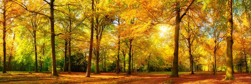


Monte Abantos
Dirección: San Lorenzo de El Escorial, 28200 Madrid.
Coordenadas: 40.61697586480004, -4.149089126989351
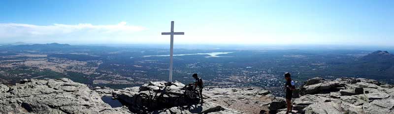
Mount Abantos is one of the most emblematic peaks of the Sierra de Guadarrama, rising above the Monastery of El Escorial. Its ascent offers one of the most spectacular panoramic views of the Madrid plateau and the Herrerian architectural complex, surrounded by dense pine forests that harbor a rich biodiversity of Iberian fauna.
Historically linked to the Spanish crown, the mountain boasts a network of well-marked trails that pass by historic springs and the famous wall of Philip II. It is a popular destination for hiking and mountain biking due to its challenging terrain and stunning scenery.
Bosque de la Herrería
Dirección: Carretera de Robledo, San Lorenzo de El Escorial, 28200 Madrid.
Coordenadas: 40.582067494564626, -4.145432475870529
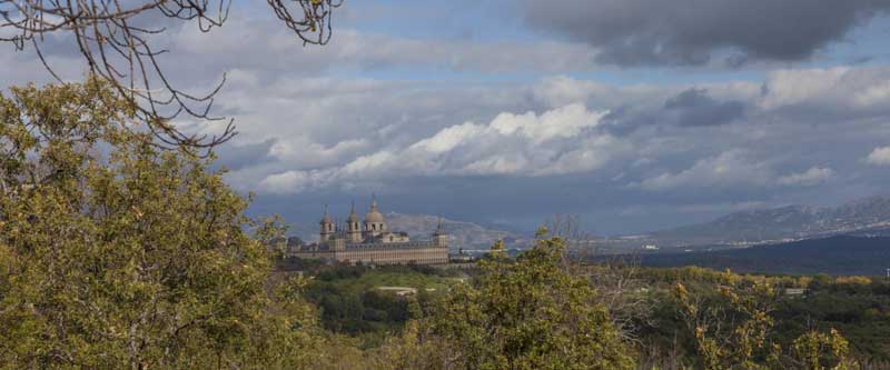
This oak and chestnut forest is a protected natural area that served as a recreational and hunting ground for the monarchy in the 16th century. Within its boundaries lies the famous Chair of Philip II, a rock formation from which, according to tradition, the monarch oversaw the construction of the Monastery of El Escorial.
The area is known for its cool microclimate and green meadows, ideal for family walks and nature photography. During autumn, the forest transforms with a palette of ochre and gold hues, becoming one of the most photogenic spots in the Madrid region.
Más info: Patrimonio Nacional – La Herrería
Camino Schmid
Dirección: Puerto de Navacerrada a Valle de la Fuenfría, Cercedilla, Madrid.
Coordenadas: 40.78942848017433, -4.037649285723085
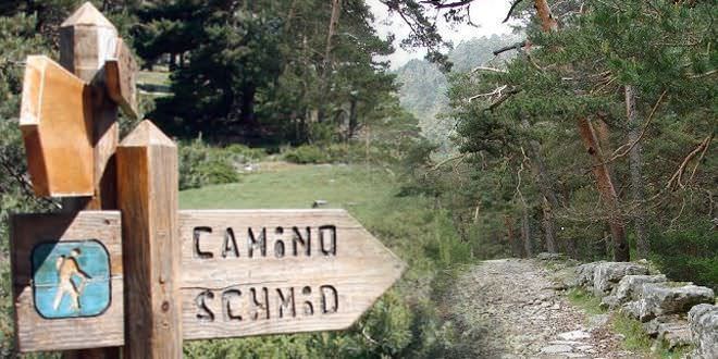
It is probably the most classic trail in the Sierra de Guadarrama, originally laid out by Eduardo Schmid in 1926. The path connects the Puerto de Navacerrada with the Valle de la Fuenfría, running almost entirely under the shade of majestic wild pines along the northern slope of the Siete Picos.
With a moderate level of difficulty, it’s perfect for those looking to enjoy the fresh mountain air without excessively steep inclines. The route crosses alpine meadows and small streams, offering an immersive experience in the heart of the National Park.
Aviso:Very busy on weekends. It is recommended to arrive at Puerto de Navacerrada before 8:30 AM to find parking.
Detalle de ruta: Itinerario Parque Nacional Guadarrama
Bola del Mundo (Alto de las Guarramillas)
Dirección: Navacerrada, 28491 Madrid.
Coordenadas: 40.785373015991425, -3.978978551356204
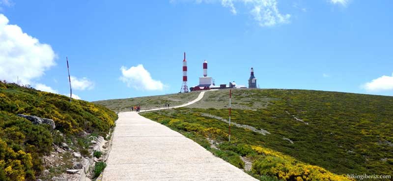
Known for its iconic rocket-shaped television antennas, Bola del Mundo is the westernmost peak of the Cuerda Larga mountain range. Accessible from the Navacerrada Pass via a concrete track, it offers views that reach as far as the Madrid skyline on clear days.
It’s a key location for winter sports and a constant challenge for road cyclists due to its extreme slopes. Broom and low scrub vegetation dominate this high mountain landscape, where wind and snow are the main features for much of the year.
Advertencia: The weather can change dramatically in just a few minutes. Warm clothing is essential, even in summer.
Cárcavas del Pontón de la Oliva
Dirección: Patones de Abajo, 28189 Madrid.
Coordenadas: 40.8830801971654, -3.4416471546953025
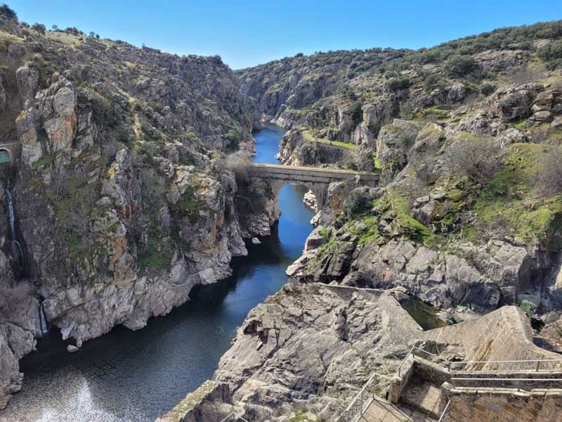
This almost lunar landscape is one of the best-kept secrets of northeast Madrid. The gullies are spectacular geological formations created by water erosion on reddish clays, forming fairy chimneys and deep furrows that contrast with the green surroundings of the valley.
The trail leading to the top of the gullies offers a breathtaking view of the Pontón de la Oliva reservoir, the oldest dam in the Canal de Isabel II system. It’s an ideal route for geology enthusiasts and those seeking unusual landscapes.
Aviso: Avoid rainy days or those that follow, as the clay ground becomes extremely slippery and dangerous.
Hayedo de Montejo
Dirección: Montejo de la Sierra, 28190 Madrid.
Coordenadas: 41.10364837024986, -3.489660943329267
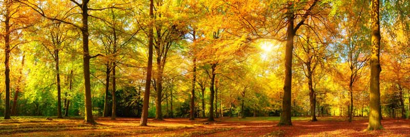
This beech forest, one of the southernmost in Europe, was declared a World Heritage Site by UNESCO. Located in the Sierra del Rincón mountain range, the beech forest survives thanks to a special microclimate and the humidity from the Jarama River.
Due to its protected status, visits are limited and require prior booking, ensuring a peaceful and environmentally friendly experience. In autumn, the visual spectacle is unique in Spain.
RESERVA OBLIGATORIA:Entry is impossible without a pass. Book your free ticket at the Centro de Información de la Sierra del Rincón.
La Pedriza
Dirección: Manzanares el Real, 28410 Madrid.
Coordenadas: 40.7729547160076, -3.8698690393692456
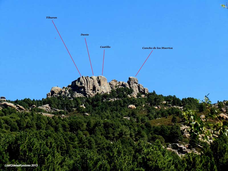
La Pedriza is a granitic batholith with whimsical shapes located on the southern slopes of the Sierra de Guadarrama mountain range. It is world-famous among climbers for its grippy slabs and iconic crags such as “El Yelmo.”
The Manzanares River rises nearby and flows along the valley floor, creating natural pools surrounded by rockrose and pine trees. This labyrinth of rocks is a sanctuary for birds of prey such as the griffon vulture.
Control de Acceso: There is a daily limit on the number of vehicles allowed in the Canto Cochino parking lot. In summer it fills up before 7:30 AM.
Laguna de Peñalara
Dirección: Puerto de Cotos, Rascafría, 28740 Madrid.
Coordenadas: 40.83971239468891, -3.9570741341180624
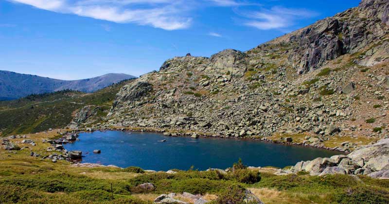
Of glacial origin, this lagoon lies at the foot of Madrid’s highest peak. The surrounding area is a perfect example of cirque-glacial landforms, with moraines and rocky walls that are home to protected amphibian species.
The access road from Puerto de Cotos is equipped with wooden walkways in its most sensitive sections to protect the alpine flora. It is a rewarding and accessible high-mountain route.
Prohibición: Bathing in the lagoon or bringing dogs into the water is strictly prohibited to protect the amphibian ecosystem.



Leave a Reply